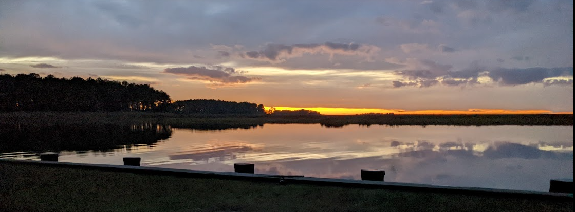
Riparian Rights and Oyster Aquaculture

“No one can so use the navigable waters in front of the riparian owner’s property as to interfere with his rights, and when the owner wants to make improvements he can do so, even if they absolutely destroy any structure or other thing in the way of the improvements not there by the consent of the owner of the shore.”

This was the holding of Hodson v. Nelson, a decision of the Court of Appeals of Maryland in January 1914, almost exactly 100 years ago as I write.   In the case, Mr. Hodson was a riparian owner of land surrounding a cove in the Chesapeake Bay.  Mr. Nelson was a waterman operating a crab business in the cove, including erecting a “crab shanty” on piles not connected to the shore.  The riparian owner sought to prevent the waterman from maintaining structures in the cove, but was not directly impacted by the crab shanty, and did not have a pier in the cove.  Despite the strong language quoted above, the Court held that the landowner did not have the right to force the removal of the crab shanty.

In 1942, however, the Court of Appeals considered Culley v. Hollis, in which I riparian owner was built a pier that extended into an underwater oyster lease area.  The waterman filed suit to stop the pier, but the Court of Appeals confirmed the fact that the riparian owner was allowed to build a pier, and that an oyster lease on the bottoms could not prevent the construction.

With the tremendous loss of oysters and crabs in the Chesapeake over the past 100 years, the tension between riparian owners and watermen diminished greatly, and has not been the topic of an important decision in decades.  According to studies, the oyster population in the Chesapeake dropped to about 1% of historic levels by 1994, and has remained very low.  In 2009, Maryland began a significant initiative to increase oyster populations — this effort included the streamlining and expansion of oyster aquaculture in Maryland.  It should be no surprise that the expansion of oyster aquaculture has also created new tensions with riparian owners.

In recent months, I have represented two groups of landowners who were concerned about oyster leases being granted in front of their properties.  In one instance, the primary concern was oyster floats anchored just off their property.  The second involved oyster cages being placed in shallow water immediately in front of the groups’ properties and piers.

There are two types of oyster leases in Maryland.  There are “submerged land leases” which allow a waterman to put shell on the bottom and exclusively harvest the oysters.  There are also “water column leases” which allow the waterman to place floating baskets on the surface or cages on the bottom and grow oysters in that manner.  There are a variety of restrictions and limitations on where a lease can be located, including leases may not be within 50 feet of a shoreline or pier without permission; leases cannot be in a submerged aquatic vegetation protection zone; and they cannot be in a public oyster fishery (typically a natural bar).  My groups’ primary concern in both cases were with the water column leases, which placed equipment at or near the surface.

If you are faced with a lease being placed in front of your waterfront property, there are steps that you can take.  If the proposed lease meets the statutory requirements, the DNR is required to provide notice to owners of property that will be directly affected.  Riparian owners can file a petition with the Department of Natural Resources challenging the issuance of the lease.  In all likelihood, there will be efforts to reach a compromise, but if not, a hearing will be held before the Office of Administrative Hearings.  In that hearing, the DNR will present the case for the lease; the owners must be prepared to present concerns and arguments against it.

J. Dirk Schwenk is a Maryland Real Estate, Waterfront Property, Civil Litigation and Maritime Lawyer from Annapolis, Maryland.  He provides civil litigation services in contract disputes, environmental and zoning issues, adverse possession and boundary disputes.  He graduated cum laude (with honors) from the University of Maryland School of Law and has been in private practice in Maryland ever since.

Setbacks, Buffers and Variances

Setbacks, buffers and variances are some of the more confusing concepts in real estate law.  Both setbacks and buffers establish a distance from something (like a boundary line or a stream) and both setbacks and buffers limit development in the area.  In Maryland, setbacks and buffers are generally established by County or City ordinance.

In this simple diagram, the property owner cannot build next to the side lot lines because of setback restrictions, and cannot build near the water due to the required buffer zone.  The developable area, therefore, is that part of the lot that can be used without violating a setback or a buffer.

These restrictions would be fairly straightforward, except that a property owner can apply for a variance from the restrictions, which would allow him or her to build into the buffers and setbacks.  The word “variance” in this context basically means “waiver” – the property owner asks that zoning board waive the setback or buffer restrictions.

Under the Anne Arundel County Code, principal structures (houses) in residential areas must meet setbacks of 5 feet from the front lot line, 10 feet from the rear lot line and 7 feet from the side lot lines.  A setback can be granted under the following provision:

Anne Arundel County Code (2005) art.18 sec.16-305

Variances.

  (a)     Requirements for zoning variances. The Administrative Hearing Officer may vary or modify the provisions of this article when it is alleged that practical difficulties or unnecessary hardships prevent conformance with the strict letter of this article, provided the spirit of law is observed, public safety secured, and substantial justice done. A variance may be granted only if the Administrative Hearing Officer makes the following affirmative findings:

         (1)     Because of certain unique physical conditions, such as irregularity, narrowness or shallowness of lot size and shape or exceptional topographical conditions peculiar to and inherent in the particular lot, there is no reasonable possibility of developing the lot in strict conformance with this article; or

         (2)     Because of exceptional circumstances other than financial considerations, the grant of a variance is necessary to avoid practical difficulties or unnecessary hardship and to enable the applicant to develop the lot.

Assuming that there is something unusual about the lot dimensions or topography that makes development difficult, a variance is likely to be granted.  There are a second set of factors that the hearing officer will consider in determining the appropriate scope of the variance – the hearing officer must decide that (1) the variance is the minimum variance necessary to afford relief; (2) the granting of the variance will not: (i) alter the essential character of the neighborhood or district in which the lot is located; (ii) substantially impair the appropriate use or development of adjacent property; (iii) reduce forest cover in the limited development and resource conservation areas of the critical area; (iv) be contrary to acceptable clearing and replanting practices required for development in the critical area or a bog protection area; nor (v) be detrimental to the public welfare.

It is much more difficult to avoid, by variance, the impact of the critical areas buffer.  Critical area protections are established by state law, but its specifics are enacted by each locality in their zoning laws.  In Anne Arundel County, the basic buffers are established in 18-13-304 of the zoning code.

18-13-104.  Buffers, expanded buffers, and buffer modification areas.

  (a)   Buffer. There shall be a minimum 100-foot buffer landward from the mean high-water line of tidal waters, tributary streams, and tidal wetlands. Specific development criteria apply as set forth in Article 17 of this Code and COMAR.

  (b)   Expanded buffer. Except as provided in subsection (c), the 100-foot buffer shall be expanded beyond 100 feet to include contiguous sensitive areas, such as slopes of 15% or greater and hydric soils or highly erodible soils.

For waterfront lots, a 100 foot buffer can significantly diminish the buildable lot area, and the buffer can be expanded significantly if there are steep slopes, erodible soils or streams and wetlands.  At times, this can leave a lot with no area that can be developed without a variance.  A landowner can seek relief by obtaining a variance from the critical areas laws — variances can be granted if the following terms are met.

  (b)   Requirements for critical or bog protection area variances. For a property located in the critical area or a bog protection area, a variance to the requirements of the County’s critical area program or the bog protection program may be granted if the Administrative Hearing Officer makes the following affirmative findings:

     (1)   Because of certain unique physical conditions, such as exceptional topographical conditions peculiar to and inherent in the particular lot or irregularity, narrowness, or shallowness of lot size and shape, strict implementation of the County’s critical area program or bog protection program would result in an unwarranted hardship, as that term is defined in the Natural Resources Article, § 8-1808, of the State Code, to the applicant;

     (2)   (i)   A literal interpretation of COMAR, Title 27, Criteria for Local Critical Area Program Development or the County’s critical area program and related ordinances will deprive the applicant of rights commonly enjoyed by other properties in similar areas as permitted in accordance with the provisions of the critical area program within the critical area of the County; or

        (ii)   The County’s bog protection program will deprive the applicant of rights commonly enjoyed by other properties in similar areas within the bog protection area of the County;

     (3)   The granting of a variance will not confer on an applicant any special privilege that would be denied by COMAR, Title 27, the County’s critical area program to other lands or structures within the County critical area, or the County’s bog protection program to other lands or structures within a bog protection area;

     (4)   The variance request is not based on conditions or circumstances that are the result of actions by the applicant, including the commencement of development before an application for a variance was filed, and does not arise from any condition relating to land or building use on any neighboring property;

     (5)   The granting of a variance will not adversely affect water quality or adversely impact fish, wildlife, or plant habitat within the County’s critical area or a bog protection area and will be in harmony with the general spirit and intent of the County’s critical area program or bog protection program;

     (6)   The applicant for a variance to allow development in the 100-foot upland buffer has maximized the distance between the bog and each structure, taking into account natural features and the replacement of utilities, and has met the requirements of § 17-9-208 of this Code;

     (7)   The applicant, by competent and substantial evidence, has overcome the presumption contained in the Natural Resources Article, § 8-1808, of the State Code; and

     (8)   The applicant has evaluated and implemented site planning alternatives in accordance with § 18-16-201(c).

The critical area variance provisions require the developer to affirmatively show that there can be no reasonable building without a variance.  It also requires the developer to do sufficient planning and engineering to prove that the development will be no worse for development that fully forested buffer lands.  For better or worse, the real world effect of these provisions is that variances are only available to highly sophisticated and deep-pocketed applicants.  For those that are opposed to a development within the buffer, there are significant avenues that can be pursued — but in many cases effective opposition also requires significant engineering and legal expertise.

In conclusion — variances are exceptions to existing law that are available to a property owner if he or she has property that could not reasonably be developed without some sort of relief from the laws on the books.  Variances exist, at least in significant part, because the Supreme Court of the United States has determined that government cannot strip the value from real property by passing laws that prevent its reasonable use.  That sort of law is deemed a regulatory taking without compensation, and violates the United States Constitutional prohibition against the government taking citizen’s property without just compensation.

Maryland Adverse Possession

Adverse Possession, sometimes known as squatter’s rights, is the legal concept by which a person can come to own real estate by taking possession of it and holding it for a certain period of years.  In Maryland, the land must be held for a period of 20 years — many other states require shorter periods.  Under Maryland law, “to obtain title to property, the person claiming adverse possession must prove actual, open, notorious and visible, exclusive, hostile and continuous possession of the claimed property for at least 20 years.”  The classic case of adverse possession is, as between two neighbors, one fences in or builds on a part of the property that belongs to the other.  After 20 years, the property is deemed owned by the person that fenced it in or built on it.   The relationship between the parties may be friendly, but the acts of one must clearly against the legal interests of the other.

Most cases where adverse possession becomes an issue are far more complicated, however.   When trying to prove adverse possession, it is common that there have been multiple owners during the period and it can also be difficult to know who first built a structure or when it was built.   Many times a fence has been built, rebuilt and moved over the course of time.  Other times one party has used and maintained the property, by mowing the grass, raking leaves, etc., but has not fenced it in.  All of these sorts of issues present opportunities for counsel to dig up and present helpful facts from the past.   The burden of proof will be on the Plaintiff to show possession for twenty years — they can also “tack on” years in which their predecessor owners used and maintained the property.   The nature of possession that needs to be shown may be different, depending on what kind of property is at issue: “acts sufficient to demonstrate possession of wild, undeveloped forest may fall short of the activity needed to establish possession of developed property.”

If the Plaintiff can demonstrate exclusive possession for 20 years, the burden shifts to the Defendant (the person that has a deed for the property) to show that the use was not adverse.  There are two primary ways to show this: 1) show that the possession was with permission from the landowner; or 2) show that the deeded owners of the land took back possession by acts at least as dramatic as those that were used to obtain possession by the adverse possession claimant.  The “mere act of going upon the land is not enough. The owner must assert his claim to the land or perform some act that would reinstate him in possession, before he can regain what he has lost.”

All of these issues require historical evidence to be amassed and presented; historical imagery to reviewed; and more than likely “I remember when” testimony from people who have been around for 20 years or more.  It is also likely to require the expertise of a good land surveyor.

Dirk Schwenk is real estate attorney from Annapolis, Maryland.  He can be reached at dschwenk@baylawllc.com.  


Maryland Riparian Rights

Owning waterfront property can be a fantastic experience — the comforts of home with an exceptional view.  But there can be issues, and it important to know the relative rights and responsibilities that go with such property.

To secure riparian rights, one must have a deed that reaches the water (such as the a lake, stream or Chesapeake Bay) and does not contain an express reservation of rights.  Direct and unfettered access to the water (and from the water) is the central right that makes riparian property, and also secures the other crucial issue — the ability to keep anyone from blocking ones view of the water.

Such rights, however, can be encroached upon by a neighbor’s pier, or transferred to a community association for the rights of the community, or otherwise impeded. These situations can create great conflict within a community, and have grave and permanent implications to the economic and personal interests of property owners. The text below provides a general overview of riparian rights, based on Maryland law.  Riparian rights in the Eastern United States are very different from those in the West (where consuming the water is key), so this is most applicable on the East Coast.  For specific questions, please contact us directly.

Maryland’s Court of Appeals has described riparian rights as follows:

“It is well established that the title to land under navigable water is in the State of Maryland, subject to the paramount right of the United States to protect navigation in the navigable waters.

The owner of the fast land, however, has a common law right to land formed by accretion adjacent to the fast land and has the right of access to the navigable part of the river in front of his fast land, with the right to make a landing, wharf or pier in front of his fast land, subject, however, to general rules and regulations imposed by the public authorities necessary to protect the rights of the public.

When the statutory law grants the right to a riparian owner to extend his lot or to improve out to the limits prescribed by the public authorities, the riparian owner receives a ‘franchise-a vested right, peculiar in its nature but a quasi property of which the lot owner cannot not be lawfully deprived without his consent.’

When the lot owner makes improvements in front of his lot, complete title then vests in him in the improvements provided it is in front of his lot and does not appropriate the riparian rights of his neighbors.”

Parsing the language, one finds the following principles.

1. The State owns the land under the water, and the United States has an overriding interest in preserving public navigation.

2. The waterfront property owner has the right to accretion (such as a beach deposited by currents) and access, but a government may regulate access such as piers and wharves to assure that public rights are protected.

3. The right to extend and improve, where granted, transfers with the property.

4. The right to extend and improve does not allow a landowner to intrude on his neighbor’s rights.

5. The riparian owner has the “right of access” to and from the waters.

Other Maryland decisions focus on the “right of access” as the most important issue — and it is.  Access is what is improved when building a pier; access is what is denied if someone else tries to build in front of ones’ waterfront property.

Since everyone has neighbors, the relative rights of one’s neighbors can become an issue, as can the extent of the government’s right to regulate. And such issues can and do evolve into open disputes. If you find yourself in conflict, issues are complicated, and delay may be fatal.  In particular, if a neighbor seeks a permit that you believe interferes with your rights, action should be taken as early as possible.  There are issues on which the local zoning board has a large amount of discretion, and even a reviewing Court may have difficulty unwinding a local decision.

Title Insurance – What Does It Cover?

Title insurance is required in most purchases of real property, but what does it cover?  What losses can a property owner suffer that should be submitted to insurance?  The answer is a bit of a cruel joke among real estate attorneys — Title Insurance does not cover a great deal.

The Court of Special Appeals recently issued a decision in Back Creek Partners v. First American Title – a case which the court helpfully described as “about title insurance, specifically what it does and doesn’t cover.”   The underlying dispute involved issues in the Annapolis neighborhood of Harbor View, a ten home subdivision on a beautiful section of Spa Creek.  Not coincidentally, the question of the appropriate location of an access easement from the lots to the pier has been in litigation there for many years.  It may be the most litigious neighborhood in Maryland.

Back Creek, the developer that purchased, subdivided and created a plat denoting a waterfront access easement, sought to recover its litigation costs from First American Title Insurance Company.  The insurance was supposed to cover any loss or damage incurred if: 1) title to the estate was other than described in the policy; 2) any defect or lien or encumbrance on the title; 3) unmarketability of title; or 4) lack of a right of access to and from the land.  On first read, one might think that there would be coverage for a years-long dispute about the correct location of an access easement which also raises the question of who actually owns what parcel of land.  Not so.

When Defendant Back Creek sought reimbursement for attorneys’ fees incurred defending itself against a lot owner, First American moved for judgment on the basis that 1) the policies had expired; 2) that there was no coverage for the claims; and 3) that they did not receive timely notice of the claim.  These arguments were successful in the trial court.

The Court of Special Appeals ultimately upheld this decision, ruling that the claims made by the homeowner did not fall within the scope of coverage.  “Title insurance in general is meant to protect title to property as it existed at a particular time; these title policies in particular covered claims relating to the title that Back Creek obtained when it bought the property and the titles that it passed to the Harbor View neighbors.”  The case brought against Back Creek did not raise issues about whether there was good title to the real estate, and there were not allegations of a “defect in Back Creek’s title or the titles it conveyed to the Harbor View residents, nor any liens or encumbrances that hadn’t been disclosed.”

The court went on to note that the policy conditions provided coverage only “so long as the insured retains an estate or interest in the land … or so long as the insured shall have liability by reason of covenants of warranty made by the insured.”  In this particular case, Back Creek sold the lot a person, and that person sold the lot to the buyer that sued Back Creek.  Once the second transfer occurred, the court held that this severed Back Creek’s obligations to warrant title, and so even though they were sued, they could not recover their attorneys’ fees from the title insurer.   The Court did emphasize that a title insurer is required to defend a case “if any claim raised by the insured potentially falls within the scope of the policy.”  That was not the case for Back Creek, however.

So what does title insurance cover?  The classic case is where you purchase a property from a person that has a deed, then later another person comes forward with a deed to the same property.  If the other deed is valid, and it is based on a transfer that occurred prior to your chain of title, then you did not actually purchase the real estate because your seller did not own it.  Your losses should be covered by title insurance.  Similarly, if it turns out that there is a prior mortgage or other lien against the property that was not known at settlement, resolving that claim would be covered.  Finally, if it turns out that a piece of property does not actually have access — such as a flag lot where the access strip did not really convey — this should be covered.

A word of caution, however.  It is not infrequent that one person purchases the property with title insurance.  Then, they later transfer the property to an LLC that they own or a family member, and no title insurance is obtained.  Just as in the Back Creek situation, the second transfer likely voids any title insurance.

If you have an issue that may be covered, it is wise to submit the potential claim to the title insurance company as soon as a possible.  Look carefully at whether the Plaintiff alleged claims that may be covered.

Good luck, be careful, and if you need a solid opinion on your rights under a policy, consult a good attorney.

J. Dirk Schwenk is cum laude graduate of the University of Maryland School of Law, and is active cases involving real estate, riparian rights, and vessel purchase issues.  He can be reached at dschwenk@baylawllc.com or 410 775 6805.


Top 5 Waterfront Property Issues

by Dirk Schwenk – dschwenk@waterfrontlaw.com and Mike Piasecki III – mike@marylandwaterfrontproperty.com

There is nothing that can compare to the peace, tranquility and sense of well-being that accompanies ownership of a piece of waterfront property. That feeling should not be disturbed by legal problems that can be prevented or at least managed. In waterfront property there are a few issues that arise with such regularity that they should be considered prior to any purchase. Mike Piasecki, III, Associate Broker, Prudential Carruthers Realtors in Elkton and Ocean Pines (www.marylandwaterfrontproperty.com) and J. Dirk Schwenk, attorney at Baylaw, LLC (www.waterfrontlaw.com) got together to come up with a “top five” list of things that should be thought through. These issues are focused on Maryland waterfront property, but they apply everywhere where piers, views and access to the water are of top concern. Here they are:

1. Community Waterfront versus Private Waterfront.

Many waterfront, waterview and water access properties are located in developments where the original developer subdivided a large tract and reserved the waterfront for the use of all of the houses in the neighborhood. Interior houses may be listed as “water access” properties and have affirmative rights to community beaches, boat ramps and other facilities. In many of these developments, there is also a strip of land that lies along the water and surrounds the entire community and was intended to allow for members of the community to walk and have access to the entire waterfront. The ownership structure of these walks can vary widely, but if they are present, there are special concerns for the homes nearest the water. Those homes may have the right to build and maintain a pier — but the pier may actually be owned by the community and be available for all of the members to use. Or there may be no right to a pier at all. The possible variations are too numerous to list, but an owner purchasing “waterfront” in such a community should be sure to understand exactly what the obligations and benefits are in the particular community.

2. Waterfront versus Waterview.

A true “waterfront” property is one that has riparian rights associated with it. In Maryland and most of the states on the East Coast of the United States, the owner of a property that has riparian rights has the right to apply to construct a pier or other waterfront improvement, has the first right to apply for permits for waterfowl hunting, and has the right to prevent others from impeding access to the water or the view of the water. In contrast, a “waterview” property is generally one that is close to the water, but has land owned by someone else between the land and the shoreline. A waterview may have a limited (or no) right to build a pier and may not have any guarantee that another owner will not build a fence, structure or put in plantings that obstruct the waterview. Careful consideration should be paid to what might be placed between the waterview property and the water — if it is community land on which nothing can be built that is very different than private land on which someone in the future may build a multi-story home.

3. Pier Locations, Boundary Lines and Permits.

Having (or keeping) a pier is a first priority consideration for many waterfront lots. It is not relaxing and fun to have a dispute with a neighbor about whether a pier is on his property, your property, on the line, should be shared, or whether a pier that you were counting on using is even legal in the first place. If you are considering a home where there is currently a pier or where you would like to put in a pier, its continued viability should be examined. First, consult with planning and zoning — was the existing pier built with a permit (or grandfathered?), or if you would like to put in a new pier, can an adequate pier be placed on the site given environmental limitations and the location of neighboring piers? Second, is there any dispute with a neighbor about the location of any of the piers (does a pier encroach the property line extended into the water?) or is there an expectation that a pier will be shared? If you are purchasing a property that is one of several that were previously owned by a single family, it is very common that multiple homes shared a single pier. This sort of agreement should be spelled out — or it can quickly lead to a disagreement.

4. The Obligation and Ability to Maintain the Waterfront.

For any property that faces significant wave action or is on a bluff, there will be erosion concerns. For all waterfront properties, there are significant legal restrictions on the owners’ ability to clear growth and trees, to fill eroded areas, and to construct shoreline protection. The cost and ability to obtain permits for waterfront repairs and maintenance should be considered. For example, in many waterfront communities, there are existing bulkheads or revetments. Depending on the particular community, the cost to maintain these structures may lie with the nearest individual landowner or with the community. In Ocean Pines, Maryland, for example, all properties in the community must pay an annual HOA assessment toward the upkeep of common area facilities, but in the instance of waterfront properties, the assessment may also cover the cost of maintenance to the property’s bulkhead. We say “MAY” because this is true in some sections of Ocean Pines, whereas in other sections, waterfront property owners, although they still pay an annual assessment that is higher than a land locked property, have the cost and burden of bulkhead maintenance placed squarely upon the homeowner. Sounds confusing doesn’t it? This example is exactly why you should consult a waterfront law specialist, and/or waterfront specialist real estate broker before entering into a contract to sell or purchase waterfront property anywhere, but especially in the state of Maryland. Another instance? In Anne Arundel County, Maryland, there have been news reports of criminal charges being filed because a waterfront property owner hired a landscaper to clear trees and bushes along the waterfront. Just like piers, it is wise to consult with knowledgeable professionals and zoning departments before becoming set on plans for improvements.

5. Choose the right professionals.

Purchasing and owning waterfront is meant to improve ones quality of life, and usually it does. There will always be an unfortunate few that end up purchasing a large, unexpected and expensive dispute, and their quality of life is most often not improved. Without question, the best means of avoiding unexpected difficulties is to associate with professionals with experience and interest in waterfront and riparian properties. A good realtor will know the particular area where a property is located, or will know the questions (like the ones above) that must be analyzed in order to know if a property is right for you. A good lawyer will know whether a deed is to transfer all of the rights you expect, (or maybe just some), will be able to spot misunderstandings in pier sharing agreements, and will know how to resolve a dispute that does arise. We hope these pointers help to make your next waterfront property purchase or sale, an enjoyable one!

Dirk Schwenk – dschwenk@waterfrontlaw.com
and Mike Piasecki III – mike@marylandwaterfrontproperty.com

Types of Maryland Land Surveys

I regularly receive calls from landowners that have a conflict (or potential conflict) with a neighbor over the boundaries between their properties.  For waterfront property, this may involve the location of a pier.  For the homes in planned and platted communities, this may involve the location of a paper road or community land.  For everyone it might involve a question of where exactly is the shared line between two properties.  These locations may be obscured by installed fences or sheds, by a history of maintenance in one area or lost to history.  It is very common that the potential client, and perhaps their opposing neighbor, do not know where the location is that is called for in the deed or plat.

 Usually one of my first questions is whether the property has been properly surveyed.  If so, this will narrow the field of dispute a great deal.  Oftentimes the property owner does not have a survey or if they do only has the Location Drawing that they received at purchase or perhaps just the neighborhood plat.  The plat is an important legal document which is relevant (and may establish) the legal boundaries, but it is not the same as being able to locate actual boundaries in the field.  In Maryland, there are several kinds of surveys identified in the regulations, each of which serves a different purpose.  Any qualified surveyor should be able to perform them – a very good surveyor will also be able to testify as needed.  Oftentimes there will be multiple categories on a single plat, but it is good to know what you are looking at, and what you should be able to expect from your surveyor.  Here are some thoughts on each type of survey.

1. Location Drawings.  A location drawing is the depiction of the property you receive when you purchase a house.  Although it looks like a survey, it hardly qualifies.  To start with, although you may not remember, if you received one you had to sign a piece of paper that says: A LOCATION DRAWING IS NOT A BOUNDARY SURVEY AND CANNOT BE RELIED ON BY ANYONE TO SHOW WHERE THE PROPERTY’S BOUNDARIES ARE.  The purpose of a boundary survey is to “locate, describe and represent the positions of buildings or other visible improvements affecting the subject property.”  For a location drawing, the surveyor is offering the insurance company and mortgage company an assurance that any improvements to the property are within the boundaries — but that is it.  There are no true assurances to the owner of the size or location of the property, whether there are easements across it, or any of the other items that are likely to cause disputes.

2. Boundary Surveys.  A boundary survey “is a means of marking boundaries for sufficient definition and identification to uniquely locate each lot, parcel or tract” and to “establish, reestablish or describe … the physical position and extent of the boundaries of real property.”  If you have a dispute with a neighbor about where the property line is, this is the type of survey that you need.  The surveyor should mark the corners of the property with survey stakes and provide a plat of the area.  To create it, the surveyor will do field work including locating any existing boundaries and markers and review the chain of title to determine what is called for in the deeds.  The surveyor is to accept and review private and public records, and note conflicting boundary line locations.  Field work is to include measurement of locations to an accuracy of 20 millimeters and take account of visible encroachments and visible indications of rights including those asserted by adverse possession or prescription.

3. As built, Constructed or Record Surveys: This is the type of survey that is done where there is a question about whether something that has been constructed (say a fence, building or pier) is in the correct location in relation to the boundaries.   They are required to have sufficient accuracy to “permit the determination of whether the position of visible constructed improvements encroach upon adjoining properties” in rights of way or in easements.  In the case of a pier, this will mean that a determination must be made, typically by asking the County zoning officials, of where the riparian line is to be drawn.

4. Field Run Topographic Survey: this is the correct survey if the contours of the property are needed, including the location of the mean high water line for waterfront properties.

5. Field Run Planimetric Survey: This is similar to a location drawing, except that it is done as a full survey in order to “locate, describe, map or all of these, the horizontal positions of the physical features and characteristics of the earth and other features.”

6. Metes and Bounds Description: Instead of a depiction of the property on a plat, this is “a written legal description of the subject tract of land that provides information necessary to propertly locate the property on the ground and distinctly set it apart from all other properties.”

7. Right of Way/Easement Surveys: An easement or right of way is a legal right of one person to access property owned by another.  It might be a narrow walking path to reach a beach or other feature, or it might be a complete right of use (such as a community park) that prevents the deeded owner from developing the property in any way.  An easement survey “is a means of obtaining, reporting, or displaying … the necessary data to establish or reestablish the location of sufficient property lines of the affected tract of land to assure the accurate location of the strip or parcel of land being described for the use and benefit of others.  Markers need not be set, but the survey is otherwise required to meet the same standards as a boundary survey.

8. Special Purpose Surveys: This is essentially a catch-all category that covers anything aside from the first seven types noted above, but it is not to be used to lower the required standards described in the regulations.

Dirk Schwenk is a graduate, cum laude, from the University of Maryland School of Law.  He practices in real estate, waterfront and riparian law and Maryland boating issues.

Boundary Disputes and Land Surveys

Maryland’s highest court issued a decision last week in Webb v. Nowak, a case about boundary disputes.  The case arose because the Nowak’s cut down and sold timber on a parcel of land that the Webb’s believed they owned – this led to accusations of trespass and claims of adverse possession.  Both parties obtained surveys to determine where the boundary line was supposed to be.  The original 1928 deed set the mutual property line at an “existing fence” and then ran from the fence “340 feet more or less” to a road.  The Nowak’s surveyor concluded that there were remnants of a fence and other evidence of its location when he surveyed almost 80 years later in 2007.  His testimony included pictures of a fence post, the borings of a tree that had grown around a fence post and a description of a swale that he concluded indicated the edge of a formerly tilled field.  He therefore concluded that the 340 foot measurement was a mistake, and the distance should only be about 200 feet.  The Webb’s surveyor relied on a point 340 feet from the road, but did not note any evidence of a fence at that location.

For a starting point, the Court of Appeals concluded that there was a question of fact concerning the correct location of the boundary.  A “determination of which of two surveys reflected the true boundaries of disputed land as intended by the original surveyor is a question of fact.”  Webb v. Nowak, 83 SEPTTERM 2012, 2013 WL 4417573 (Md. Aug. 20, 2013).

 The determination of the boundary line in this case … must involve comparing the Wolf deed to conditions in the field—e.g., the location and condition of the Existing Fence, the location of the Private road and County road, the location of other monuments, the topography of the land, and even the location of surveyors’ pins.”

 Webb v. Nowak, 83 SEPTTERM 2012, 2013 WL 4417573 (Md. Aug. 20, 2013).  The Court went on to conclude that the 340 foot measurement was a mistake, because the fence was a monument and “monuments control over courses and distances where they continue to exist, or their locations can be determined with reasonable certainty.”  Webb v. Nowak, 83 SEPTTERM 2012, 2013 WL 4417573 (Md. Aug. 20, 2013).

The takeaway for a current landowner?  First, if there is a dispute about the correct boundary in a deed, the testimony of a surveyor will be of paramount importance.  This brings me to land surveys — In Maryland, land surveyors are licensed by the State and the state regulates what must be included in certain types of surveys.

What most people receive when they buy a house — a location drawing — is the lowest form of survey and it cannot be given to someone unless they acknowledge in writing that “A LOCATION DRAWING IS NOT A BOUNDARY SURVEY AND CANNOT BE RELIED UPON BY ANYONE TO SHOW WHERE THE PROPERTY’S BOUNDARIES ARE.” COMAR 09.13.06.06.  The purpose of a location drawing is only to “provide some assurances that improvements are located on the property.  This assurance is for the use of a lend or an insurer only.”  Id.  So a homeowner that purchases a property is not supposed to rely on the location drawing for assurances that the boundaries are correct.

An accurate and reliable survey that is likely to be accepted in Court needs to be at least a Boundary Survey.  A boundary survey will establish and mark the “physical position and extent of the boundaries of the property” and requires that monuments (surveyors stakes) be set and a plat produced.  COMAR 09.13.06.03.  Conducting the survey is what will place the surveyor in a position to testify as an expert to the location of the lines.  And in the case of Webb v. Nowak, it is what put the surveyor in a position to testify that a line described in a deed as 340 feet was really only 200 feet – and that testimony made all the difference.

For more on types of surveys, see Types of Land Surveys

J. Dirk Schwenk graduated from the University of Maryland School of Law in 1997, cum laude, and practices in real estate, waterfront land riparian rights and marine issues in Annapolis, Maryland.

Latent Defects v. Manufacturer’s Defects in Marine Insurance

There are lots of potentially hidden issues in a boat.  I have seen engines destroyed by the use of aluminium and iron together.  I have seen stringers with saturated, rotten plywood cores; hulls full of soaked balsa coring and massive delamination caused by improper foam cores or improper installation of foam cores.   These sorts of issues lead to severe losses and sleepless nights.  For new boats under warranty, these losses will first be the responsibility of the builder.  For the rest, the main question will be whether there is any coverage from the marine insurance.

When a boat owner reports a loss that is not obviously due to a collision, the adjuster and surveyor will certainly be looking for evidence of an uncovered manufacturer’s defect.  In the case of core problems, the insurer is very likely to deny coverage on that basis unless there is clear evidence of a collision that punctured the outer hull.

Most marine insurance covers all losses unless there is a specific exclusion that applies (this is known as an “all risks” policy), so losses are considered covered absent an exclusion.  Most policies exclude all losses that are caused by manufacturer’s defects by excluding coverage for damages caused by “manufacturer’s defect(s) or manufacturer’s defect(s) in design. “  At the same time, most policies exclude latent defects, but cover damage that result from a latent defect with language that excludes “the cost of replacing or repairing any item having a latent defect that causes damage to your insured property, however, resulting damage would be covered.”  A latent defect is usually defined to mean a hidden defect that existed from the time of manufacture.

In many cases, a hidden defect can be viewed as both a manufacturer’s defect, in the sense that it was due to a mistake of the manufacturer, and a latent defect, in that it was hidden and existed from the time of manufacture.  Insurance adjusters may deny coverage if it is a close call or if the cause is actually unknown, but seems like a manufacturer’s defect.  The courts that have reviewed such cases have reached very different decisions.

For example, in French Cuff v. Markel, a case out of Florida, the court considered 64 foot catamaran in which the bulkheads failed because the coring was “too thin or friable.”  The court concluded that this was both a manufacturer’s defect and a latent defect.  Under Florida law, an insurance policy is read to favor the insured, and therefore coverage existed for the loss.  However, the case Carrier v. RLI (applying New York law) considered the loss of a large catamaran due to a bad safety hatch.  In that instance, the Court again considered the problem to be both a manufacturer’s defect and a latent defect.  Under New York law, however, exclusions are applied in the order that they are listed in the policy.  The manufacturer’s defect exclusion was listed first, and therefore there was no coverage.

Since the cases, facts and policy language are all inconsistent, here are some things to keep in mind if the issue arises:

1. Choice of Law: Generally the state’s law that applies to an insurance contract is the state where the policy was issued or the state where the policy was delivered.  These may be different, and state chosen may lead to a completely different result.  Analyze this issue early and choose carefully.

2. Policy Details: The specific language of the policy will be very important.  The surveyor for the insurance company will know how to look for facts that will cause an exclusion of coverage.  A boat owner seeking coverage should be aware of the specific language of the policy and be sure to advocate for a determination that the cause is covered.

3. No Known Cause:  Sometimes when there is no readily ascertainable cause, it will be termed a manufacturer’s defect in order to exclude coverage.  In that instance, the all risks nature of marine insurance should force coverage, but it may take additional advocacy to make sure that it happens.

Good luck and let me know if I can be of assistance.

Dirk Schwenk

Surveys and Boat Purchase

For most previously owned boats sold through a broker, it is routine to recommend that the boat be surveyed with the professional surveyor prior to committing to the purchase.  In the vast majority of cases, those surveys turn up issues that are either cleaned up prior to closing; negotiated as a reduction to the purchase price; or they stop the contract altogether.  The parties complete the deal and go their separate ways.  In some cases though, issues arise after closing that lead to disputes.  In my experience, disputes fall into one of four categories: 1) hull or stringer core problems (usually rot); 2) discrepancies between the listed inventory and the delivered inventory; or 3) non-hull survey items that were missed; 4) mechanical problems that were not covered by the survey contract.  Any of these can cause significant post-closing issues.

If there are post-purchase problems, the buyer will be holding the bag.

In the event that there are significant post-survey, post-closing issues, a purchaser can pretty much assume that everyone else involved will step back and deny liability (previously owned boats are different than new boats insofar as they are not warrantied).  Brokers and Sellers will (probably correctly) say that they did not know about the problems, or if they did, that it was the Buyer’s responsibility to find them with a survey.  The surveyor, in all likelihood, will have a contract signed by the Buyer that specifically releases him from all negligence or failure to detect problems, and states outright that the survey cannot be relied on.  The crucial lesson for the purchaser — pick a very high quality surveyor and you would be well advised to personally test every item on the boat as well.  Be absolutely, positively sure that any item listed in the inventory that matters to your purchase is on the boat at the time of inspection, and on the boat at the time of closing.  Buyers should also be aware that if they execute a “conditional acceptance of vessel” that notes certain problems, absent fraud or intentional concealment, the list of items is all that they will be able to enforce if bad things happen.  Sellers, surveyors and brokers — the best course of action is probably to rely on the contract protections written into the deal, and obtain good counsel in the event of a significant claim.

Hull and Core Problems

Hull, core and stringer problems — especially wet, rotten core issues — are usually the worst cases because a bad hull or bad stringers may be so expensive to fix that they make the boat a total loss.  Stringers are notoriously difficult to fix without taking the whole boat apart.  For this reason, a buyer should be certain that proper soundings are performed, a moisture meter is utilized, and if there are any remaining questions, should either walk away or seek further help, such as thermal imaging.  A buyer will have real difficulty recovering any money from insurance or a seller for wet hull issues unless it can be shown that the seller knew about the problem but concealed that in the sale.

Listed inventory versus delivered inventory.

Most boat listings include an inventory of electronics and other features that will transfer with the vessel.  These are usually assembled by the broker and reviewed by the seller prior to the listing — they also usually come with the reminder that the inventory is believed to be accurate but cannot be relied on.  Some items on the inventory will be of limited value, but significant sails, outboard engines, navigational equipment, etc., can be very expensive.  Buyers should confirm that anything that matters is with the vessel, and confirm that it is in acceptable working condition.

Items that should have been picked up in the survey, but were missed.

Generally, a buyer’s recourse for missed items would be against his own surveyor, but that recourse may be limited by the survey contract.  It is a good idea to attend the survey and test everything in the same way that a surveyor would — if it is broken you want to know that before the purchase, not after.

Mechanical Surveys

Most hull surveys do not include any mechanical testing beyond running the boat and noting any discrepancies in the readouts or the boat’s ability to operate properly.  Items such as leaking oil may be noted, but compression problems, worn parts, or other issues that a fully trained mechanic testing the engine would pick up may not be in the survey.  Surveyors will typically recommend that a buyer get a mechanical survey.  As with other issues, if the buyer completes the contract, and it cannot be shown that the seller knew of the mechanical problems, in all likelihood the buyer will have to pay for any engine repairs without recourse against any other party.

Conclusions

Buyers should be diligent in obtaining a survey from a qualified surveyor and taking the effort to be sure that the survey is thorough; no items are missed; and the inventory is accurate.  Sellers, Brokers and Surveyors should be sure that there is contract language to protect them from any claims of problems with the boat that were discovered (or arose) post-closing.  If a dispute does arise, quality representation and investigation will be absolutely imperative.